Geospatial Information Tools for Sustainable Groundwater Management in West Africa
NASA SERVIR Applied Science Team
Brigham Young University, Provo Utah, USA
The project is funded by the NASA SERVIR program. The objective of the SERVIR program is to assist developing countries in using Earth Observations to assess, analyze, and sustainably manage natural resources and to improve lives. SERVIR works with a set of regional "hubs" serving more than 30 countries. These hubs are located in Amazonia, West Africa, East and Southern Africa, Hindu Kush Himalaya, and Mekong. Every three years NASA selects a set of twenty projects (four per hub) led by US universities and agencies to form an Applied Science Team that works with the regional hub to deliver science, data, training, and capacity building in areas that have been identified as priorities in the regions. Our project was funded in October, 2019 and will continue through October, 2022. We are working with the West Africa hub which services the countries of Niger, Burkina Faso, Ghana, and Senegal. The hub is headquartered in an organization called AGRHYMET, located in Niamey, Niger. While NASA provides our funding, our hub partners are primarily funded by USAID.
The objective of this website is to provide a repository of information, links, training materials and other resources related to this project.
Project Summary
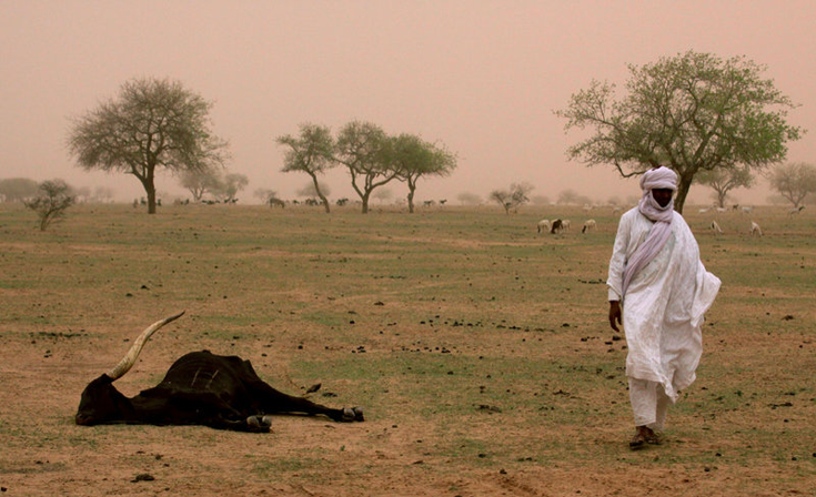
In West Africa, particularly in Niger, rain-fed agriculture is unsustainable. Groundwater development will provide a more stable water source and enhance food security. Groundwater development requires collecting and analyzing data produced at global and national levels and disseminating that data and knowledge to end users such as States, NGOs, municipalities, businesses, and agropastoralists in a format that is useful for planning and decision-making. We are developing a set of geospatial tools for stakeholders at all levels to assess and interpret groundwater data. Users can access these tools via a simple browser interface that requires minimal infrastructure or computer expertise. We are also assisting hub partners in developing and using groundwater models.
A) Groundwater Resource Assessment
The Groundwater Data Mapping Tool (GWDM) is the foundation of the system. GWDM ingests in situ water level measurements and performs temporal and spatial interpolation to build interactive animated maps or times series plots. GW-Level uses machine learning to find correlations among Earth observation data, such as precipitation or soil moisture, with water level data and perform more accurate interpolation. This approach is particularly applicable to West Africa because it ensures that scarce in situ data are used as effectively and accurately as possible. These products help water managers gain a better understanding of groundwater resources and determine how aquifers are responding to groundwater development, droughts, and climate change.
The GRACE Groundwater Subsetting Tool (GGST) provides lower resolution data that gives a current picture of groundwater conditions in terms of overall water storage volumes. GGST can identify and characterize conditions in data-poor areas or identify trends in other regions often obscured by noise from well data. GGST uses GRACE mission data to compute and display changes in water storage in a web-based mapping system and integrates GRACE-FO data. GGST uses NASA GLDAS surface water data to derive changes in groundwater. It displays the results as time series plots at selected points or map animations. This tool complements the GWDM tool, providing a secondary measure of how groundwater changes in space and time.
B ) Groundwater Model Development
We are working with our SERVIR-West Africa partners to develop new regional groundwater models. We will implement workflows using data derived from Earth Observations as forcings to these models. Groundwater modeling typically requires advanced computer and software capabilities with trained and experienced modelers.
C) Stakeholder Training and Technology Transfer
We are working with stakeholders, including AGRHYMET, The Ministry of Hydraulics and Sanitation (DGRE), the Association for the Redynamisation of Pastoralism in Niger (AREN), and the National Network of Chambers of Agriculture of Niger (RECA), to develop and provide training for these tools - the materials on this website are part of this effort. We will leverage training to refine the capabilities, tool interfaces, visualizations, and data reports.
Project Team
Our team members at BYU are:
 |
Norm Jonesnjones@byu.edu Faculty Principal Investigator |
 |
Gus Williamsgus.p.williams@byu.edu Faculty Co-Investigator |
||
 |
Sarva PullaConsultant Oversees all Tethys app development |
 |
Saul RamirezGraduate Student (PhD) Machine learning for groundwater mapping |
||
 |
Sergio BarbosaGraduate Student (PhD) Groundwater model development |
 |
Michael StevensGraduate Student (MS) Groundwater data processing and mapping |
||
Ren NishimuraGraduate Student (MS) Groundwater data processing and mapping |
 |
Lucky BahatiUndergrad. Research Assistant Groundwater data processing and mapping |
|||
 |
Rachel ValekUndergrad. Research Assistant Groundwater data processing and mapping |
 |
Eva-Marie HamillUndergrad. Research Assistant Groundwater data processing and mapping |